Many of the following trail descriptions include cross country overland travel without a well established trail. If you are not comfortable navigating with a map using terrain recognition and compass bearings, we suggest you contact a local guide service for assistance.
Around the hut
Old mule trails left from the days of hardrock mining, offer adventurous explorations around the hut, many of which do not show on popular maps. Many trail loops leave right from the back door of the hut. There are four alpine lakes within two miles of the OPUS, and more a little further out, great for an afternoon dip or fishing at Crystal lake, Clear lake or Island lake. Off trail, above treeline, endless meadows of alpine wildflowers beckon with peak blooms in the end of June and early August.
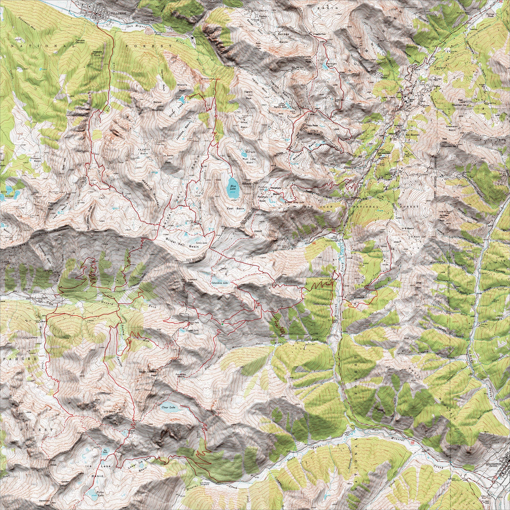
Summer Trails Map
Check out this interactive map that shows all the various hiking trails around Opus. Clicking on a segment will give you distance and elevation
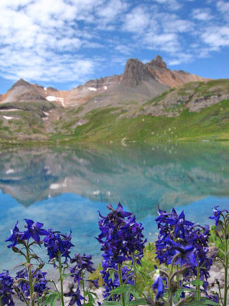
Porphyry Basin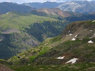
From Telluride to the OPUS Hut
To Columbine lake : 7.6 miles approx.(Telluride to Columbine Lake)
Experience the high country above Telluride, in true European fashion. Take the Gondola to the top of San Sophia station and climb to the Alpino Vino restaurant saddle. 700 feet above the Alpino Vino restaurant, go left on the the Nellie Mine road dropping into upper Bear creek and the Wasatch trail. Follow the Wasatch trail into the upper east fork of Bear creek and over to McCarron Junction in Bridal Veil Basin. From here, traverse upper Bridal Veil basin, cross country, past Lewis Lake to Columbine pass, and over to Columbine lake. There are two optional routes to the OPUS from Columbine Lake.
Via Ruby Lake : 3.5 miles (Columbine Lake to OPUS Hut)
The most direct, more difficult route to the OPUS from Columbine lake is to descend steep loose slopes to a small lake known as Ruby lake (not labeled on maps). From the east end of Columbine lake, climb 200+ feet on grassy slopes to a small col (pass). Follow a slippery game trail down towards the visible small lake in the the basin below, “Ruby Lake”, unnamed on the maps. From the south side of Ruby lake there is an old mule trail descending to the south of the lake. Follow this down 400+ feet to a bench. At the bench you will see a trail on the right, follow this traversing above a small cliff band, then turning west around the ridge and onto grassy south facing slopes. From this point, the hut can be seen in front and below you to the west, in the direction of Ophir pass. The trail is faint but marked with cairns and orange marker flags, leading directly to the hut. Note: the col route into Ruby requires some exposed moves at the top. The route is steep and very loose. Difficulty will be increased if you have a heavy pack. Only recommended for the experienced climber.
Easier/ Longer Alternative from Columbine lake via the Columbine lake trail and the Treeline Traverse: 4.6 miles (Columbine Lake to OPUS Hut)
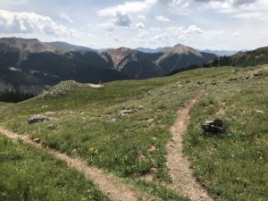
Follow the Columbine Lake trail proper, descending east toward highway 550. Just before you reach treeline there is a large visible game trail out of the drainage to your right (south). Follow this game trail over the ridge then descend 200 vertical feet following a faint trail marked with cairns. This trail will take you southeast to treeline. Follow cairns to a more visible trail leaving these meadows heading west just below 11,800 ft. This trail traverses west all the way to the OPUS at treeline (11,800 ft.). You will cross two open avalanche slide paths then come into a large open meadow. Cross the Ruby creek drainage then follow the obvious trail out of the drainage continuing south then west. The trail will intersect with a four wheel drive road, follow the road for 500 feet, then leave it on single track at a creek crossing. Back on the trail, it will cross an open bowl (“The Sound of Music”) then climb to the hut (400 vertical feet), through open meadows of wildflowers.
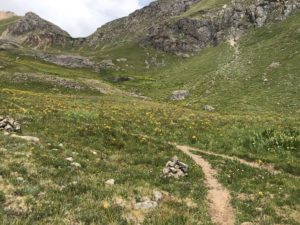
Looking at Columbine Lake Trail from the game trail that leads to Opus Hut.
To the left, the Columbine Lake Trail leads to Highway 550. To the right is the trail that leads to Opus Hut.

Traverse from Red Mountain Pass to the OPUS : 8 miles
Starting from Red Mountain pass there are two options. Your first goal is Porphyry Basin, high above the pass to the Southeast. To get there you can take either the Mineral Basin Road (forest rd. 823), or the Porphyry Basin Rd. (forest Rd. 822). Once you’ve reached Porphyry Basin, cross the basin to the south east between the five alpine lakes traversing at 12,800 ft. As you leave Porphyry Basin traverse around the next Cirque to the south with two 13,000 ft. peaks above you on the west. Descending slightly, keep an eye out for the trail traversing out of this basin at 12,500 ft. (shown on the Latitude 40 map- not others). Next you will come to the Columbine lake basin (Mill creek), cross Mill creek below Columbine lake at 12,300 ft., climb to the south 300 ft. to join the Columbine lake trail east of the lake.
Columbine Lake Trailhead to the OPUS : 5.4 miles
To get to the trailhead, begin up the Ophir Pass road. Immediately after crossing Mineral creek turn right on a dirt road heading north. The trailhead will be on your left a quarter mile up this road. Follow the Columbine Lake trail to treeline. A short distance (1,000 ft.) above the trees look for the large game trail traversing out of the basin to the climbers left, heading south, then follow the route described above in the Telluride route, from that same point.
Ruby Lake road to the OPUS Hut via the Treeline Traverse trail : 3 miles (easiest hiking route to the hut)
This approach is a nice way to get to the OPUS with some hiking and eliminates driving the steeper and rougher upper portion of the Ophir Pass road. 1.5 miles from Highway 550 the Ophir Pass road comes to a creek crossing. Just before the creek on the right is a gated forest access road. This is the Ruby Creek road. Hike up the two track road to treeline where you will come to the Treeline Traverse trail described above. Go left (west) at this junction and follow the trail across Ruby Creek and the remainder of the trail described above to the hut.
Hope Lake, Ice Lakes and the OPUS Hut : 11 miles
To get to the Hope lake trailhead, take Colorado Highway 145 to Trout lake. Drive around Trout lake to forest road 627 at the far southeast end of Trout lake. The trailhead is two miles up from Trout lake on forest road 627. Follow the well marked Hope lake trail to 11,600 ft. then traverse northeast across a large bench and climb to the saddle between Beattie Peak and Fuller Peak. Climb the south rib of Fuller Peak to the Summit. From the summit of Fuller Peak, descend north into Ice Lakes Basin. Traverse through Ice Lakes Basin to Island lake. Follow the Hardrock 100 trail climbing to Swamp Pass. From this high saddle, climb on the ridge to the east to 13,000 ft. You will see Clear Lake below you to the north. Descend to Clear Lake. From the north side of Clear Lake Climb over the ridge north into Paradise Basin. Its is also possible to stay on a high traverse to the same ridge between Clear Lake and Paradise Basin. The better places to cross the ridge are on its west end (the east Ridge of South Lookout Peak). Descend upper Paradise Basin to 11,300 ft. and watch for a good foot trail heading north at that elevation. Follow this trail the “Paradise Basin trail ” on east facing grassy slopes which will lead you to the Ophir Pass Road. Before you reach the road you will see the hut above and straight in front of you. Once you reach the road follow it to the parking area then take the foot trail to the hut.
Click to enlarge